Satellite imagery and open-source evidence lay bare the destruction to civilian infrastructure by Israel in its war on Hamas
A Guardian investigation has detailed the mass destruction of buildings and land in three neighbourhoods in Gaza.
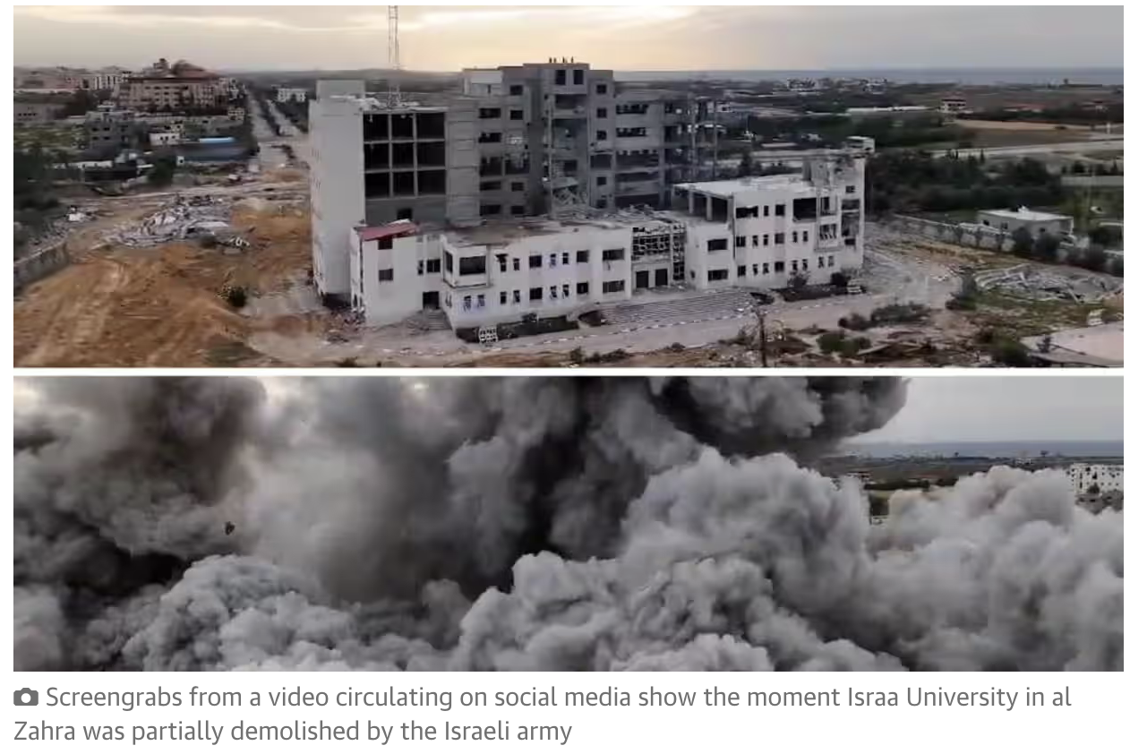
Using satellite imagery and open-source evidence, the investigation found damage to more than 250 residential buildings, 17 schools and universities, 16 mosques, three hospitals, three cemeteries and 150 agricultural greenhouses.
Entire buildings have been levelled, fields flattened and places of worship wiped off the map in the course of Israel’s war against Hamas in Gaza, launched after the Hamas attack on Israel on 7 October.
The destruction has not only forced 1.9 million people to leave their homes but also made it impossible for many to return. This has led some experts to describe what is happening in Gaza as “domicide”, defined as the widespread, deliberate destruction of the home to make it uninhabitable, preventing the return of displaced people. The concept is not recognised in law.
The Israeli military says that its fight is against Hamas and not Gaza, that its bombardment is proportional to the threat posed by Hamas and that it is making every effort to warn citizens of imminent attacks.
An IDF spokesperson told the Guardian: “Hamas operates nearby, underneath, and within densely populated areas as a matter of routine operational practice. As part of the IDF’s operations, it [has] been carrying out strikes on military targets, as well as locating and destroying infrastructure when imperatively required to achieve the goals of the war.”
Read the report and view the photos here